People are asking what is going on with water levels at Maules Creek. Elfin Crossing has stopped running, the third time in recorded history. Its dry, but is it THAT dry? We see the miners buying up farms in the area due to a range of factors; for coal, the impacts of dust and noise, and offsets – how long until it will be for water?
Checkout groundwater levels here.
- Thornfield: Bore No GW041027.1.1 (Details, Data),
- Green Gully: Bore No GW967138.1.1 (Details, Data),
- Elfin: Bore No GW967137.1.1 (Details, Data)
Heres the surface water gauge data (Details, Data) of Maules Creek at Elfin Crossing i.e. Avoca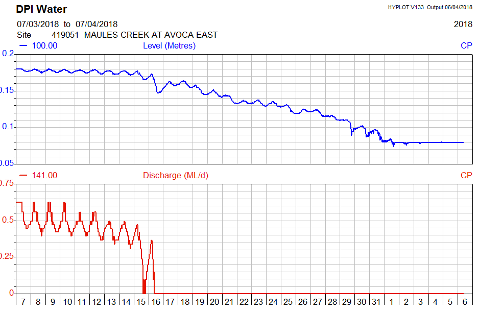
The flat line says it all. No flow!
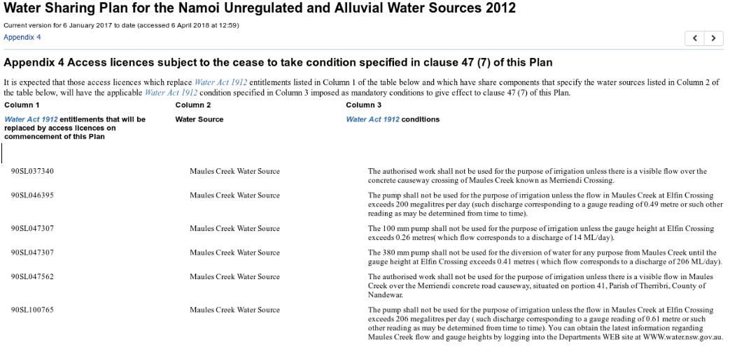
The Zone 11 water sharing plan has a cease to pump triggers on licenses drawing on the Maules Creek Water Source when water stops running over Elfin Crossing. i.e.
 We have heard rumours that there is substantial, un-metered pump operating in the mine pit and it has been pumping high volumes for quite a while. There is deep concern in the area that what happened at Quipoly is happening now at Maules Creek.
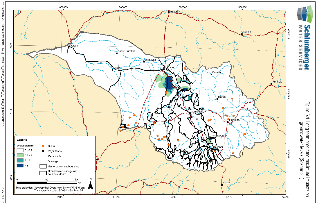
The Scenario 1 (i.e. existing approved coal mines) predictions by the Namoi Water Study appear to be playing out at Maules Creek. The map below taken from the Final Report shows a dark blue area on right (i.e. > 5m groundwater drawdown) that is much of Maules Creek.
The MCCC has written earlier about groundwater issues and the potential impacts of the coal mine. See the articles below:
Groundwater monitoring at Maules Creek
Maules Creek ground water levels continue to decline

Apr 6 2018
Water levels plummet at Maules Ck
People are asking what is going on with water levels at Maules Creek. Elfin Crossing has stopped running, the third time in recorded history. Its dry, but is it THAT dry? We see the miners buying up farms in the area due to a range of factors; for coal, the impacts of dust and noise, and offsets – how long until it will be for water?
Checkout groundwater levels here.
Heres the surface water gauge data (Details, Data) of Maules Creek at Elfin Crossing i.e. Avoca
The flat line says it all. No flow!
The Zone 11 water sharing plan has a cease to pump triggers on licenses drawing on the Maules Creek Water Source when water stops running over Elfin Crossing. i.e.
The Scenario 1 (i.e. existing approved coal mines) predictions by the Namoi Water Study appear to be playing out at Maules Creek. The map below taken from the Final Report shows a dark blue area on right (i.e. > 5m groundwater drawdown) that is much of Maules Creek.
The MCCC has written earlier about groundwater issues and the potential impacts of the coal mine. See the articles below:
Groundwater monitoring at Maules Creek
Maules Creek ground water levels continue to decline
By MCCC • Uncategorized • • Tags: Maules Creek, Now, Water