Ground Water Monitoring at Maules Creek
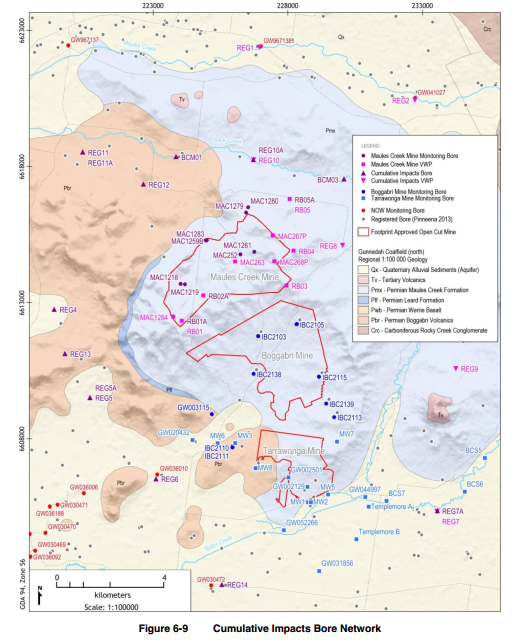
Water bores, ground and surface water monitoring sites near Maules Creek
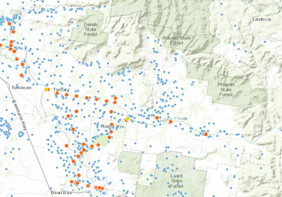
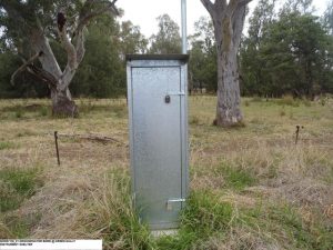
There are lot of ground and surface water monitoring stations in Maules Creek (Ground Water Zone 11) that look specifically at the alluvial aquifers.
Checkout water levels here.
Thornfield: Bore No GW041027.1.1 (Details, Data),
Green Gully: Bore No GW967138.1.1 (Details, Data),
Elfin: Bore No GW967137.1.1 (Details, Data)
Tip: For best results, only have one window to this site open at a time and wait for the data to download.
To find other NSW Government water monitoring bores in the Namoi, go to NSW Real Time DPI Ground Water Monitoring and click on Groundwater Bores –> Namoi Valley
To find groundwater bores on your property look for your bore number here Gov’t Map of Water Bores in NSW
UNSW Connected Waters Maules Creek Monitoring Stations – bore data ends June 2016. Weather station data is current.
Unfortunately the coal miners operating in the Leard Forest do not supply real time data from the extensive collection of company owned groundwater monitors. A summary of the latest Whitehaven coal mine ground water monitoring can be found in the 2016 Annual Review (9.5 MB) and in the company’s Water Management Plan (WMP) which was last revised in 2014.
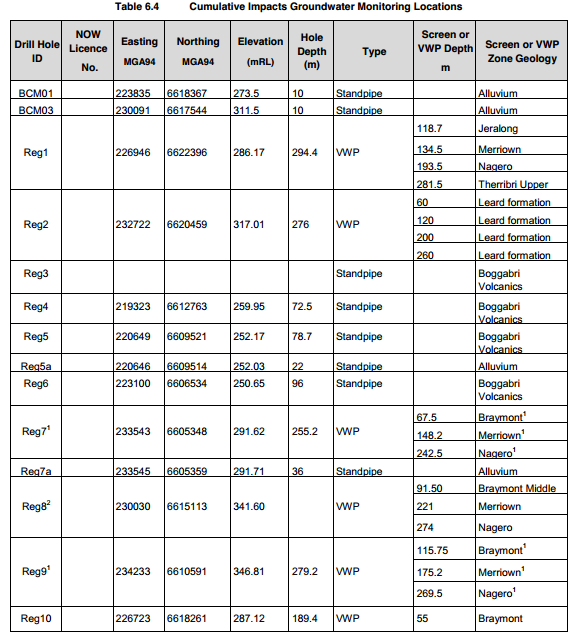
The WMP shows that some bores monitor the alluvium (BCM01, BCM02, Reg5a, Reg7a, Reg10a, Reg11a, Reg14), but many others monitor the coal seams. Some are yet to be drilled (e.g. Reg11a). See the table below for descriptions.
Reg1 near the Green Gully groundwater monitor (GW967138.1.1) and Reg2 near the Thornfield groundwater monitor (GW041027.1.1) monitor the coal seams.